(Earth) Wind and Fire for the Twin Tiers
'

NOAA says a Wind Advisory is in effect from 10 a.m. to 11 p.m. April 3.
Forecasters say West winds were expected to be steady at 20 to 30 miles per hour with gusts of 40 to 50 miles per hour. The strongest gusts will be at higher elevations.
Strong winds can blow down limbs, trees and power lines with scattered power outages possible.
Wind advisories are issued by NOAA when sustained wind speeds of at greater than 30 miles per hour and/or wind gusts over 45 miles per hour are expected. Winds of this magnitude could cause minor damage to trees, power lines and weaker structures.
People who are in the advisory area should secure all loose objects including garbage and recycling receptacles. Motorists traveling through the advisory area should keep a firm grip on the wheel, especially for those driving high profile vehicles.
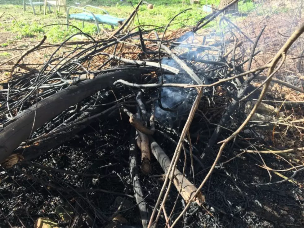
Meanwhile, the strong winds are contributing to a danger for spring wildfires in the region.

A Red Flag Warning is in effect from 10 a.m. to 11 p.m. March 3 for a combination of gusty winds and low relative humidity for Broome, Tioga, Steuben, Schuyler and Sullivan Counties in New York and Bradford and Susquehanna Counties in Pennsylvania.
The National Weather Service in Binghamton says winds gusting up to 45 miles per hour will combine with the Relative Humidity falling to 25 to 30 percent in the afternoon and warmer spring temperatures in the upper 40's to mid 50's.
Officials say that means critical fire weather conditions are likely with an increased risk for rapid wildfire growth and spread.
A Red Flag Warning means that critical fire weather conditions are either occurring now, or will shortly. A combination of strong winds, low relative humidity, and warm temperatures can contribute to extreme fire behavior.
More From KISS 104.1